By Caroline Majewski, Publishing Associate: Researcher and Writer at Save the Water™ | June 1, 2023
Watersheds and Surface Water
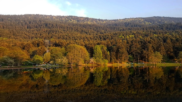
A watershed is a land area that drains surface water into streams and rivers. Watersheds drain rain and melted snow through forests and other land into streams and rivers. The water in these channels then converges with other larger bodies of water. Gravity works with the landscape with this draining process.
Surface Water
Surface water provides about 60% of the public water supply in America. Beginning as precipitation, forests collect the resulting surface water and maintain water quality. Filtration occurs via soil and other environmental factors. Subsequently, resulting in the gathering of greater channels of water.
This process is cyclical in nature. Moreover, the forest acts as a necessary environmental filter in order to maintain a healthy water source. From forests to wetlands, these same water sources also provide animals and humans with high-quality water for survival and daily use. After the water is disposed of, it will cycle back in the form of precipitation.
- Precipitation filters into rivers and streams
- Water channels converge with bodies of water
- Liquid water evaporates into the air
- Molecules condense and return to Earth’s surface
Along the way, many environmental and urban factors impact the quality and amount of water cycling through this system.
What is the Forest to Faucet?
The Forest to Faucet, a project by the USDA Forest Service, uses Geographic Information Systems (GIS) to observe the quality of surface drinking water contained in small watersheds. The data inform how certain areas of the watersheds may affect the overall water quality.
Forest to Mi Faucet: Michigan’s response
Forest to Mi Faucet, a Michigan program, uses the federal program as a starting point. The program dives into more state-specific goals and needs.
One of the main goals includes planting trees in order to increase their shared impact. In addition, the program encourages landowners to conserve their woodlands. Foresters and municipal water treatment operators must look over ‘source water assessment plans.’
In short, these plans locate the most effective places to start their efforts.
Forested Land and Water Quality
There is a direct connection between the amount of forested land and the quality of water.
The Great Lakes area, for instance, is a great example of this. The Environmental Protection Agency (EPA) rated the condition of Lake Superior good. Lake Superior has about 91% forest coverage. On the other hand, Lake Erie was given a poor condition grade. Lake Erie has only 19% forest coverage.
The higher percentage of agricultural and urban areas means greater stress. Buildings, people, and agriculture tax the land and the water flowing through it. Because of land designations (i.e. forest, agriculture, and urban designations for example), the program focuses on combined efforts between groups.
Who Owns the Forests?
Moreover, about 62% of Michigan’s forests are privately owned. Forest to Mi Faucet takes this number into account. The project will work with landowners upstream of municipal water utilities in order to ensure that shared goals are being met. A key effort will involve educating the landowners on the best practices for managing their land. This will increase the positive effects on the drinking water supply.
The program along with 12 Michigan partners will work together to accomplish the program goals.
What does it hope to accomplish?
The Michigan program has 5 main goals.
- Ensure municipal water utilities follow water protection plans
- Encourage landowner conservation (and management) of woodlands
- Plant 60,000 trees in urban and rural riparian zones
- Educate people about the program and goals
- Plant 750,000 trees in state forests
These goals work toward fostering the connection between the forests and water. The land and water resource managers use the assessments to effect decisions at the state level, which can inform future forest management plans. At its core, collaboration between the sectors is intended to speed up efficiency and results.
Forest to Faucet Resources
The assessment will help with broad-scale planning at the state and federal levels. In short, the long-term aim of these efforts is to identify other local areas that need restoration.
The assessment results can be viewed as a dataset in the Data Explorer. With this tool, forest managers and other planners track watersheds that are important for the drinking water supply. This is based on “population served, forest cover, riparian condition, and hydrology.”
The United States Department of Agriculture (USDA) gives a detailed breakdown of the program.
In summary, Forest to Mi Faucet is partnering with Michigan communities to educate, collaborate, and improve the connection between our forests and clean drinking water.


